Avian UAS a leading digital imaging and visualisation company
OUR SERVICES
Creative:
- Digital Media (photography and video)
- Case Studies and Project Updates
- Community and Stakeholder Communications
- Safety Training Videos in 360 and VR
Technical:
- Asset, site and building inspections (including thermography)
- Site analysis and visualisation (3D maps and models)
- Aerial surveys (Photogrammetry/LiDAR)
- Geo-spatial data (maps/models)
- 3D models and Visualisations
- Drafting plans, drawings, maps and cross-sections
- Point cloud data
- Custom design and build ROVs (Remotely Operated Vehicles)
Professional Surveying:
- Site context/plans
- Surveys (feature and level, sub-division, reestablishment, site context)
- Volumetric surveys (cut, fill and volumes)
- Topographic plans/contour maps
- 3D site models and maps
Training:
- Drone adoption and training
- Drone ‘safe work methods’
- Introduction to drones for commercial use
- Advanced UAV mapping and 3D modelling
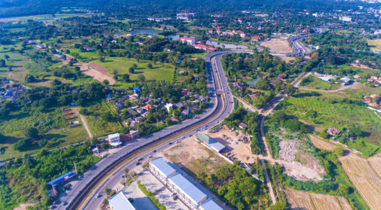
PROFESSIONAL PHOTOGRAPHY & VIDEO
We are experts in creating stunning imagery and video using cinematography techniques. Using professional grade cameras we turn the unimaginable into a visual reality. We also offer high-altitude photography using light aircraft that UAVs simply can’t capture and more traditional commercial photography and video production. Avian UAS optimise the visual medium and unique aerial perspective for TV and Film, Corporate Videos, Marketing and Events.
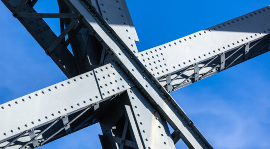
Avian UAS conduct site, asset and building inspections for engineering, construction and heavy industrial sectors. Streaming live HD video to engineers on the ground we work in some of the most difficult and dangerous environments. Our customised aerial platforms deliver real-time information and detailed reporting for preventative maintenance, defect identification and repairs or restoration work using accurate, high-resolution, in-close proximity flights. Applications include site assessments, PPE and safety audits, progress reporting and visual inspections on buildings, construction sites, bridges, mobile phone towers, dam infrastructure, pipelines and historic monuments.
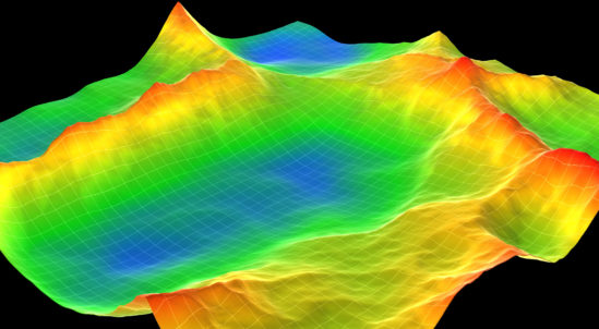
LAND SURVEYING, MAPS & 3D LASER SCANNING
We have surveyors on staff who use state-of-the-art technology to conduct accurate subdivision surveys, reestablishment surveys, 2D maps and 3D models from laser scans. Allowing clients to view and measure site dimensions or assets, geo-referenced maps, digital terrain models and volumetric surveys.
From our surveys and point clouds, you can accurately take measurements, calculate area or volumes and plan a project at each phase using the data we provide in a fraction of the time and cost of more traditional methods.
We provide risk management advice on the commercial use of UAVs and integrating them into your business enterprise and operations. There are significant legal, risk, cost and liability implications when using UAVs that many people are not aware of or fail to consider when hiring third-party service providers.
Our team have the experience and knowledge to support your projects and are active in the industry and with both local, state and federal regulatory authorities.
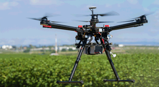
The team at Avian UAS have years of combined experience in the design, build and deployment of UAS technology for specific use cases. We work closely with clients to define and understand the problem, analyse and assess the best options, then recommend the most suitable solution. For difficult problems we collaborate with selected third parties who strategically partner with Avian UAS to deliver on more complex specifications.
Why use Avian?
Experience: Our pilots have a minimum 5 years of flight experience and are competent safely operating UAVs in difficult situations and confined spaces, allowing us to get closer to the target or to capture that award-winning shot. Our surveyors have a minimum of 10 years experience in all aspects of professional surveying.
Service: We are an agile business and specialists in data acquisition, analysis and data processing. We pride ourselves on exceptional customer service, quality, reliability, safety and timeliness while forging strong, sustainable relationships.
Quality: We produce only high-quality results and reporting. Our team spend the time to interpret and process the data so you can spend your time making timely and informed decisions. We don’t settle for a sub-standard outcome, so we don’t expect our clients to either.
Safety: We pride ourselves on our zero (0) incident safety record and follow strict operational safe work procedures in all our activities. Our UAVs are equipped with parachutes, an industry first in safety procedures within Australia. All staff are inducted into our company safety program and stringently tested on our safety procedures before deployment on any client sites.
Solutions: We design and build custom remotely operated platforms and solutions to deliver on difficult, dangerous or complex assignments. Ask us today about our in-flight projects.
Guarantee: We are confident in our capability and the quality of our services that we will supply all agreed deliverables to your expectations. If you are not satisfied with the quality and accuracy of our products we will replace them at no cost to you.


